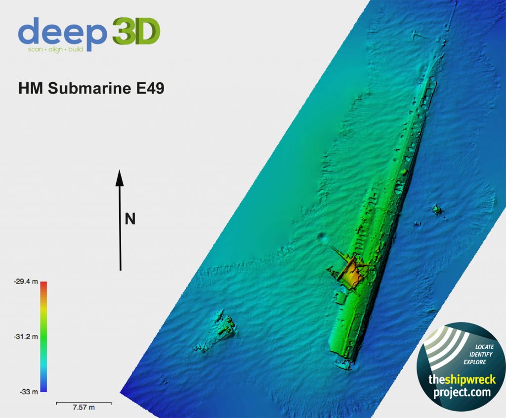
Next year sees the start of a little project run by The Shipwreck Project to find the missing pieces in a great story involving a Second World War single seat fighter that crashed in Weymouth Bay. We know the date and the fate of the pilot – he bailed out and was rescued – but we do not have his name. The answer to that question lies on the seabed, but where to start looking? One tool we have in our arsenal is the ability to create a Digital Elevation Model, or DEM. This is all thanks to project sponsors Agisoft and their package Photscan Pro. Here’s an example of a recent scan of the wreck of HM Submarine E49:-  The colours relate to height with the reds showing the highest point of the wreck, in this case the conning tower. The first step, once the bundles of ghost fishing gear and ropes are removed from the aircraft crash site, is to scan the site and then analyse the lumps and bumps on the seabed and identify how the aircraft is lying. Surveying sites from the comfort of the computer screen is so much more productive than trying to sketch the site by hand, and as in the image above we see subtle differences missed on the dive. Can you see how the sand has built up to the west (lh) side of the submarine? The lighter colours show the sand depth is greater than the east side – details like this are often missed whilst underwater. Below is the print of the submarine, in full colour:- HM Submarine E49:-

1 thought on “Digital Elevation Models”
Comments are closed.